Cars for Hire in West Garo Hills and Tura
West Garo Hills is one of the largest district of Meghalaya located in the western part of the State. The Garo Hills district was divided into two districts, viz the West Garo Hills district and the East Garo Hills district in October 1976. The erstwhile West Garo Hills district was further divided into two administrative districts of West and South Garo Hills on June 1992. The district headquarters of West Garo Hills is Tura, which is the second largest town in the State after Shillong.
The West Garo Hills district lies on the western part of the state of Meghalaya bounded by the East Garo Hills district on the east, the South Garo Hills on the south-east, the Goalpara district of Assam on the north and north-west and Bangladesh on the south.
The district is situated approximately between the latitudes 90° 30′ and 89° 40′ E, and the longitudes of 26° and 25° 20′ N.
West Garo Hills district is pre-dominantly inhabited by the Garos, a tribe with a matrilineal society belonging to the Bodo family of the Tibeto-Burman race tribes. Other indigenous inhabitants are the Hajongs, Rabhas, Koches, Rajbansis, Meches, Kacharis and Dalus. The district is also inhabited by Bengalis, Assamese, Nepalese, Marwaries, Biharis and people from other parts of India.
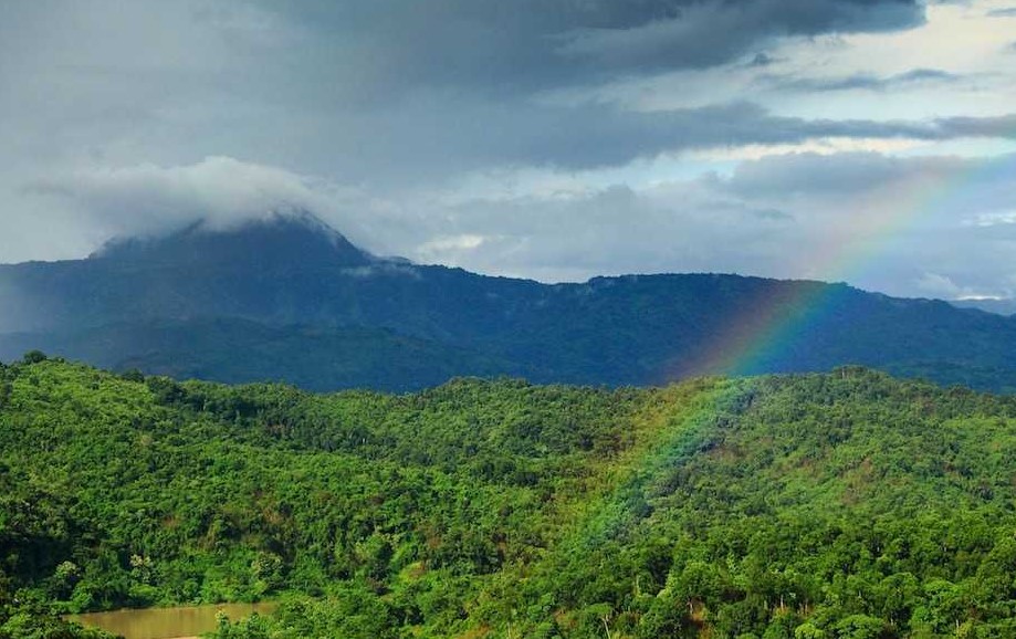
The West Garo Hills district is mostly hilly with plains fringing the northern, western and the south-western borders There are three important mountain ranges in the districts of Garo Hills.
Tura Range: This is one of the most important mountain ranges in the West Garo Hills. The Tura range is about 50 kms. long and extends in the east-west direction from Tura to Siju in the South Garo Hills district. The mountain peaks that are located in this range are Tura Peak, Nokrek Peak, Meminram Peak, Nengminjok Peak, Chitmang Peak The highest peak of this range is the Nokrek (1412 m.) lying 13 kms. south-east of Tura. To the west of the Tura range low hill ranges run from north to south, and to the north of the Tura range hill ranges run parallel to it, gradually increasing in height till they meet in the south.
Now the entire Tura range comes under the management of Nokrek National Park. These high ranges are strictly protected as Catchment areas right from the time of British Administration in Garo Hills. There is no human habitation in the heart of these ranges which has now became an ideal home to various flora and fauna.
Arbella Range: Arbella Peak is 999 metres high. It lies on the northern side of Asananggre village on the Tura Guwahati road. Most of the peaks in this mountain range fall in the East Garo Hills district.
Ranggira Range: This mountain range lies on the western fringe of the district and ends in Hallidayganj village. The height of this peak is 673 metres.
River Systems: The Tura range form watersheds in the West Garo Hills district, from which the rivers flows towards Bangladesh plains in the south and the Brahmaputra valley in the north and the west. The important rivers of the north group are the Kalu, Ringgi and the Didak. The important rivers of the southern group are the Bhogai, Dareng etc. The Tura range is also the source of the Simsang (Someswari), one of the major rivers of Meghalaya, whose valley is of the most important feature in the South Garo Hills.
Someswari: This is the largest and the second longest river in the whole district. The river is locally known as Simsang. It starts from Nokrek mountains and runs towards the east, passing through Rongrenggre, Williamnagar the headquarters of East Garo Hills district, Nongalbibra, Siju, Rewak and lastly Baghmara the headquarters of South Garo Hills district. The upper course of this river is not navigable due to the high number of cataracts and numerous huge stones. However the lower course has many deep pools and falls. They are Mirik, Matma, Kan´chru Suk, Jamiseng, Warisik, Bobra, Goka etc. The chief tributaries are Chibok, Rongdik, Rompa and Ringdi rivers
Jinjiram: It starts from Derek village and its main tributary starts from Upot Lake. It runs towards the east connecting with Gagua river, then runs through the border of Goalpara towards Phulbari and reaches Hallidayganj where it enters the Goalpara district. It is the longest river in the Garo Hills districts.
Kalu: Locally this river is called Ganol. Its sources start from Tura peak and runs towards the west through Damalgre, Garobadha and Rangapani before it enters Goalpara district. Its chief tributaries are Dilni and Rongram rivers
Didak: It stars from Anogre village and runs through Garo Hills district before it enters into Goalpara district.
Bogai: Locally known as Bugi. Its source starts from the southern side of Nokrek mountains and runs through Dalu village and enters into Mymensingh district in Bangladesh.
Rongai: Starts from Arabela peak and runs through Ringgegre village and then falls into Jinjiram river. Locally known as Ringge river.
Dareng or Nitai: The source is on the southern side of Nokrek mountain. It runs southwards through Silkigre and enters into Bangladesh. It has many famous deep pools like Warima, Rong´ang, Bamon etc. where Bamon is the deepest. The chief tributaries are Kakija, Daji and Rompa.
The climate of the district is largely controlled by South-West monsoon and seasonal winds. The West Garo Hills district being relatively lower in altitude to the rest of Meghalaya, experiences a fairly high temperature for most part of the year. The average rainfall is 330 cms. of which more than two-thirds occur during the monsoon, winter being practically dry. The district have mostly dense tropical mixed forest, and a small patch of temperate forest in the higher parts of the Tura range.
Tura, the headquarters of the district, is well connected by road with other places in the district as well as with the rest of the Meghalaya and Assam. Buses by Meghalaya Transport Corporation and other private transport services run regularly connecting Tura with all important places in the districts of Garo Hills and also to Shillong (323 kms), the capital of the State. Regular day and night bus services are also available from Tura to Guwahati (220 kms), the capital of Assam, which is also the nearest railhead. There are also regular bus services connecting Tura to Siliguri, a city in North Bengal. Also the place is connected to Dhubri in Assam by road and river transport. Bus and taxi servises are available on shared and hire basis.
We provide all types of cars for hire in West Garo Hills and Tura in Meghalaya at cheap rates.
All Categories
Recent Posts

Silchar Car Rental – Best Tour Operator in Silchar | Drivelooprental
Silchar to Guwahati Best Taxi Service – Book Verified XUV & Sedan | Up to ₹900 Off – Drivelooprental